PERRY PARK
Combining drone-based photogrammetry, geospatial data, and real-time visualization, we created survey-accurate digital twins of golf courses that enable planners, designers, and stakeholders to experience a project long before construction begins.
Using high-resolution aerial capture, we generated georeferenced terrain models and detailed site meshes that were imported into Unreal Engine to create fully interactive 3D environments. These digital replicas allowed teams to explore routing options, evaluate sightlines, test design concepts, and review course layouts in real time with a level of accuracy and immersion impossible through traditional drawings alone.
Beyond planning and design review, the same source data powered cinematic flyovers, interactive presentations, and investor-focused visualizations that communicated project vision with clarity and impact. Stakeholders could virtually walk the course, experience key viewpoints, and better understand design intent, accelerating consensus and reducing costly revisions throughout the development process.
To maintain consistency across every touchpoint, we extended the visualization pipeline into marketing and branding deliverables, producing promotional imagery, course maps, and scorecard artwork directly from the 3D models. This unified approach ensured that planning, presentation, and marketing assets all shared a common visual language grounded in survey-accurate data.
The result is a flexible platform for golf course development and promotion, delivering everything from interactive applications and web-based 3D experiences to cinematic videos and print-ready artwork. Optional enhancements include custom viewing tools with annotation and measurement capabilities, multiple presentation styles, and tailored branding packages designed to support projects from concept through launch.
-
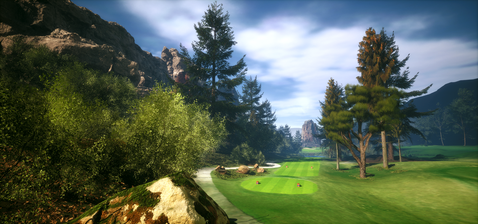
![Low camera shot, in the grass, of a golf course. terrain captured with Lidar data and rendered in Unreal 5.0]()
Realistic dramatic renderings
-
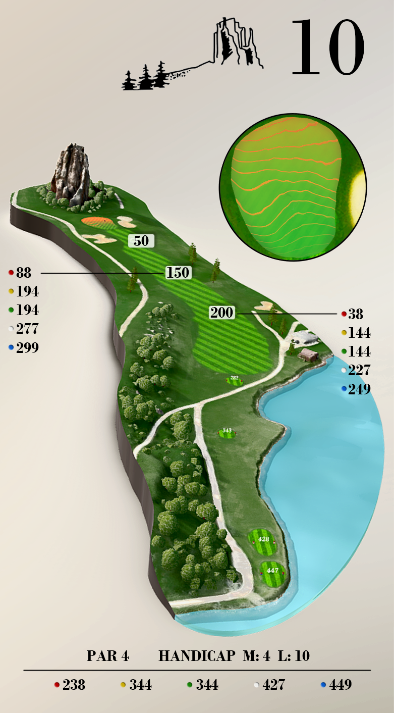
![Illustration for golf course score card.]()
Scorecard and course materials
-
![Three quarter view of a lush green golf course. Terrain captured with Lidar data and rendered in Unreal 5.0]()
High resolution